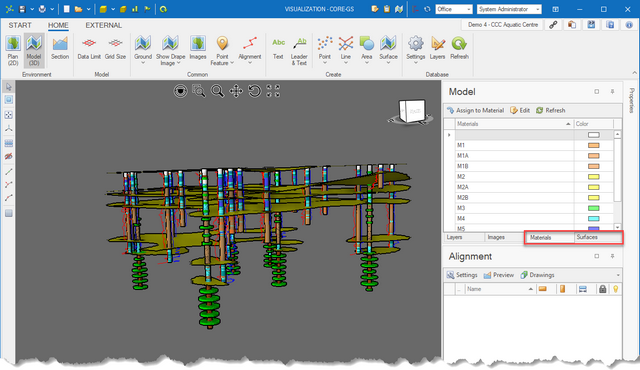
The Visualisation Module provides powerful visualization tools to undertake ground characterization.
The advanced modelling tools are only available in the 3D model environment and are used to define, create and confine interpreted surfaces:
•Material Assignment - assign each geological layer to a material group. that has been logged
•Surface Generation - create surfaces based on the top / bottom of material groupings.
•Surface Limits - define surface limits to terminate surfaces against other layers
Ground characterization is the process of bringing together observations and test results to define and understand ground conditions to simplify material definitions across a site.
The process may include data from:
•mapping (i.e. geological, geomorphic)
•investigation (i.e. geology, in-situ, geophysical and laboratory tests)
•monitoring
The results are used to automate the generation of material reports, allowing for the determination of design parameters.
Undertaking the ground characterization process should only be considered when there is a reasonable amount of data to model. Trying to apply this process on a limited data set will provide limited benefit. In the latter case, manually annotating sections with interpreted boundaries will be more efficient.
The following sections provide:
•Understanding - details the process used
•Material list setup - discusses the selection and editing of material lists
•Surface options - details the different options available when generating surfaces
•Assigning materials - discusses the preparation and process typically used to assign materials
•Limiting surfaces - covers the process of applying limits to the extent of surfaces
