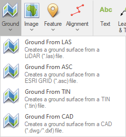
The Ground tools, located in the Common Tools group on the Home page, provides options to import 3D ground data from various file formats.

Selecting the Ground menu opens a drop-down menu with four options to generate a ground surface.

|
Ensure that data in the file to be imported is in the same coordinate system as data in the model. |
•Ground From LAS - creates a Ground surface from a LiDAR (*.las) file.
•Ground from ASC - creates a Ground surface from a ESRI ASCII GRID (*.asc) file.
•Ground from TIN - creates a Ground surface from a ASCII TIN (*.tin) file.
•Ground from CAD - creates a Ground surface from a CAD (*.dwg/*dxf) file.
Once data from the file is read, this data is automatically converted into a triangulated surface that is added to the Ground layer.